Tropical Storm Nate moves slightly east
Published 11:45 pm Friday, October 6, 2017
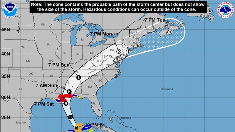
- The Birmingham National Weather Service is forecasting Tropical Storm Nate to move across Alabama on Sunday.
The forecast track for Tropical Storm Nate moved slightly east Thursday.
However, the storm is still expected to bring wind gusts up to 50 miles per hour, 4-6 inches of rain and an isolated tornado threat to Selma during the day Sunday.
Dallas County is under a tropical storm watch until 10 p.m. Sunday.
The National Weather Service predicts Nate will strengthen to a Category 1 hurricane before landfall near the mouth of the Mississippi River and moving over Alabama.
Graphics from the National Weather Service in Birmingham forecast a peak wind gust of 58 miles per hour for Selma and sustained winds of above 40 mph. That would be strong enough to potentially bring down some trees and power lines.
The predicted rainfall has increased slightly to 4-6 inches. However, due to the recent dry weather, flooding is not expected.
The greatest tornado risk will be southeast of Selma, roughly east of Interstate 65 and south of Interstate 85.